July 2014
I’ve always known the Bow River Pathway to be a popular commuter route for cyclists heading downtown to work. Beyond that, I was curious if one of Calgary’s most popular pathways would be suitable for a leisurely family bike ride, or if my five year old son would get knocked over by faster cyclists.
The City of Calgary has the most extensive urban pathway and bikeway network in North America with close to 800 km of pathways that connect communities, parks and natural areas across the four corners of the city. We decided to start exploring the pathways close to home this summer as a family and we’ve currently worked our way from Shouldice Park in the far northwest corner of Calgary down to Pearce Estate Park in the southeast, a distance of approximately 15 km.
We’re working our way along the Bow River Pathway from NW Calgary down to the far SE city limits in Fish Creek Provincial Park and hopefully by the September long weekend, we’ll have reached Sikome Lake for a well-deserved swim!
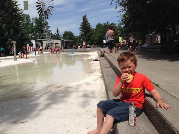
taking a rest and cooling off at Eau Claire Market’s wading pool
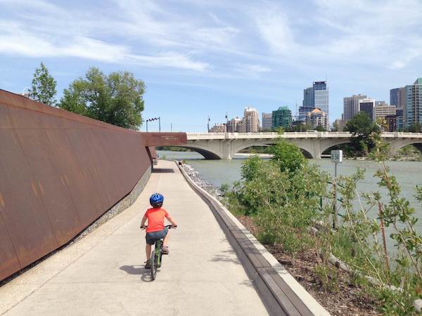
Getting started on the Bow River Pathway
Choose a starting point and decide if you’ll do the ride as a one-way ride with shuttle (which works well if you finish at a playground and have a second adult who can ride back for your vehicle,) or if you’ll bike a shorter distance and ride out and back. If you choose the latter, it’s wise to look for a playground, wading pool, or some other interesting attraction for the half-way point. Our favourite turn-around spot for having lunch and resting is Eau Claire Market downtown. There’s a wading pool, playground, indoor market with food court (perfect if you forgot to pack a lunch,) and even an indoor playground in case it starts to rain and you need to end your ride early. And, there’s ice-cream, which is a powerful motivator for tired feet that need some encouragement to keep pedaling.
Our favourite family sections of the Bow River Pathway
Shouldice Park to Edworthy Park, NW – Total return distance of approximately 4km. Stop at Edworthy Park for ice-cream at Angels Café, play at one of the playgrounds in the park, and watch for trains that pass by frequently. The pathway is mostly flat with small short hills. We park at the big playground at Shouldice Park beside the leisure centre, and then bike towards Home Road along the river to get on the official pathway.
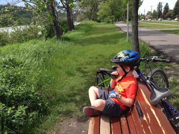
enjoying the scenery and a break near Edworthy Park
Edworthy Park, NW to Eau Claire downtown – Total return distance of approximately 14km. Have lunch and play in the wading pool at Eau Claire, visit the playground on Prince’s Island and bike through the Peace Bridge. For a great loop, you can ride downtown on the north side of the river from Edworthy Park and then return on the south side. At the moment, the south side of the river pathway is closed between the Crowchild bridge and Edworthy Park for repairs but when this section of pathway opens, it’s a beautiful ride below the Douglas Fir Hiking Trail. In the meantime, take the bike underpass below the Crowchild bridge to return to the north side of the river as you make your way back to Edworthy. The loop is mostly flat with gradual hills. Expect steeper hills when you go under the bridges downtown.
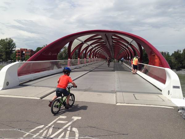
Calgary’s beautiful Peace Bridge
Parking can be very hard to find on the north side of Edworthy Park but there’s always parking to be found on the south side off of Bow Trail.
Eau Claire to the East Village and Inglewood, SE – For a short ride, bike along the downtown River Walk on the south side of the river from Eau Claire Market through the East Village. It’s a great ride for young children with only a couple of kilometres distance return and there are no big hills other than the ones going under the bridges at Centre Street and Edmonton Trail.
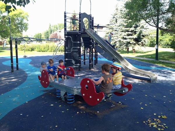
Nellie Breen playground
Beyond Edmonton Trail, (4th Street,) it gets a bit tricky with construction at the far end of the East Village, but there is signage in place to guide you around Fort Calgary to the community of Inglewood. Once you’ve made your way back onto the Bow River Pathway, you’ll have to make a quick jog south onto the Elbow River Pathway as you cross the Elbow River at a nearby bridge. Make your way back north after crossing the Elbow River and continue east into Inglewood towards the Nellie Breen Playground. You’ll find this gem of an urban playground at 14th Street and St. Monica Ave, and it’s easy to find because the pathway goes right past the playground. From Eau Claire to Nellie Breen, it is approximately 8km return.
If the kids still have energy after a rest at the playground, you can continue on to Pearce Estate Park and the Bow Habitat Station in a few more kilometres return. There’s a great playground at Pearce Estate Park and you’ll also find walking paths with marsh areas and viewing platforms.
One of the easiest places to find affordable parking near Eau Claire Market is at the Curling Club on Memorial Drive, just across the river from Prince’s Island Park. You can find free street parking along the side streets off Memorial Drive as well but they only offer two hour parking.
Special Notes about Biking the Bow River Pathway
This pathway gets very busy so if you are biking with young children, it’s best to avoid rush hour periods when commuters are out in force. Children should also be reminded to bike on the right hand side of the path at all times unless passing and to stop at all road crossings. (There are many small road crossings through Inglewood especially.)
While I have tried to provide accurate information in this story, it is highly recommended you check the City of Calgary’s website for up to date pathway notices, trail closures, and to verify all distances on the section you plan to ride. There is an excellent interactive map on the website that shows distance markings and even shows which trails have snow removal in winter. And, if you tend to get lost easily like me, make sure you get the City of Calgary’s pathway and bikeway mobile app for your phone so that you can quickly verify where you are while out riding. The app features the same interactive map that you would see on your computer.


